
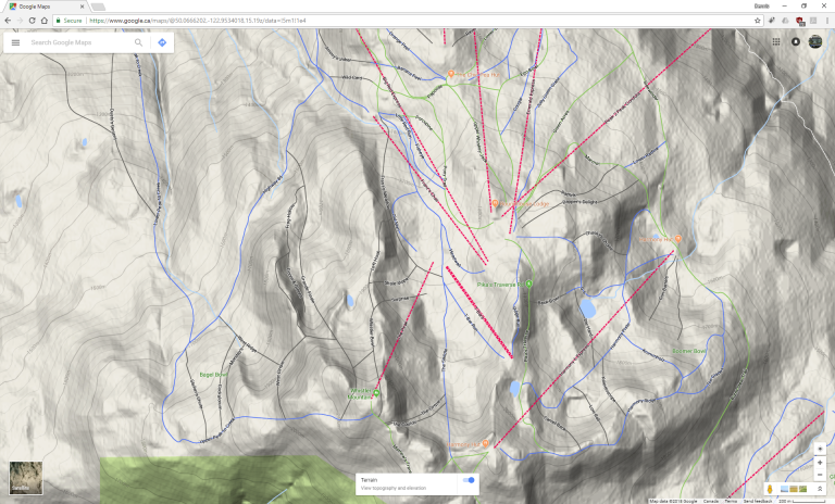
Whistler Blackcomb is pretty big, so one would usually look at a map to find suitable runs. What is provided in the “Mountain Atlas” looks nice and mostly works, but for map geeks is there anything better? Turns out that Google Maps conveniently has the ski runs in its map. But there’s more: Google Maps in Terrain mode shows the contour lines like a topographic map!