My cousins from Toronto came over to ski and snowboard at Whistler over the last month. I had the opportunity to pick up skiing again and accompany them up at Whistler a few times.
Whistler Blackcomb is pretty big, so one would usually look at a map to find suitable runs. This is a sample of what is provided in the “Mountain Atlas”:
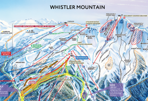
It looks nice and is mostly useful. But for all the map geeks out there, can we find anything better?
Turns out that Google Maps conveniently has the ski runs in its map. But there’s more: Google Maps in Terrain mode shows the contour lines like a topographic map!
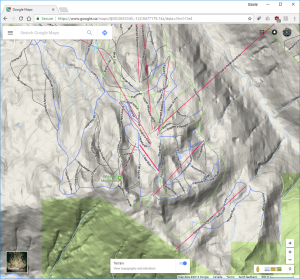
Beautiful! The top-down view makes it easy to see the actual orientation of the run and “behind” the mountains, and the contour lines makes the rate of descent visible. So from here you can see there is a green run from the Peak—Mathew’s Traverse—whereas it’s not depicted on the trail map.
How do you get to the map?
Here’s the link: Google Maps Terrain @ Whistler
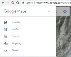
Alternatively you can search for the location you want in Google Maps, then open the menu at the top left, then select “Terrain” mode.
